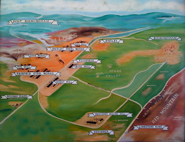
Early in the 20th century, railroads crisscrossed through Birmingham to connect steel mills and transport natural resources mined in our area throughout the country. I found this old map (above) in Bessemer’s Hall of History Museum, housed in a refurbished and very interesting old train station (seen in watercolor on left), which put it in better perspective for me. Many of these tracks and industrial sites have been abandoned and incredible images of the decay are posted HERE. Bob wants to paint a map of the railroads currently in use through Birmingham, but it’s been difficult for us to find information and connect all the dots. We’ll keep looking but suggestions are WELCOMED!
Birmingham Rails is a GREAT site for Birmingham railroad information. We found this 1935 rail map here This is just one small piece of a very extensive map scanned by Birmingham Rails in 8 1/2 x 11 inch segments and shows the downtown area.
